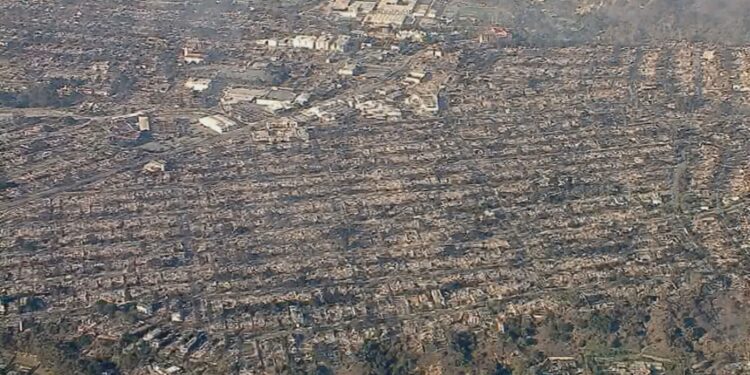
Unprecedented wildfires are decimating thousands of structures, displacing thousands of residents, destroying local landmarks, and threatening many more across Los Angeles County. At least five people have been killed in the tragedy.
With 27,000 acres and counting either burned or still burning, the place that millions of Americans call home is almost unrecognizable. Photos from the path of destruction show communities completely transformed, as the personal, cultural, and economic losses continue to mount.
Take a look at the destruction facing residents as firefighters attempt to control the blazes.
Pacific Palisades
The Pacific Palisades are seen before and after a fire swept through the area in a satellite image provided by MaxarTechnologies.
@MaxarTechnologies
Malibu
Overview of beachfront homes before and after fire swept along La Costa Beach, in Malibu, Calif., in a satellite image provided by MaxarTechnologies.
@MaxarTechnologies
Palisades and Eaton Fires seen from above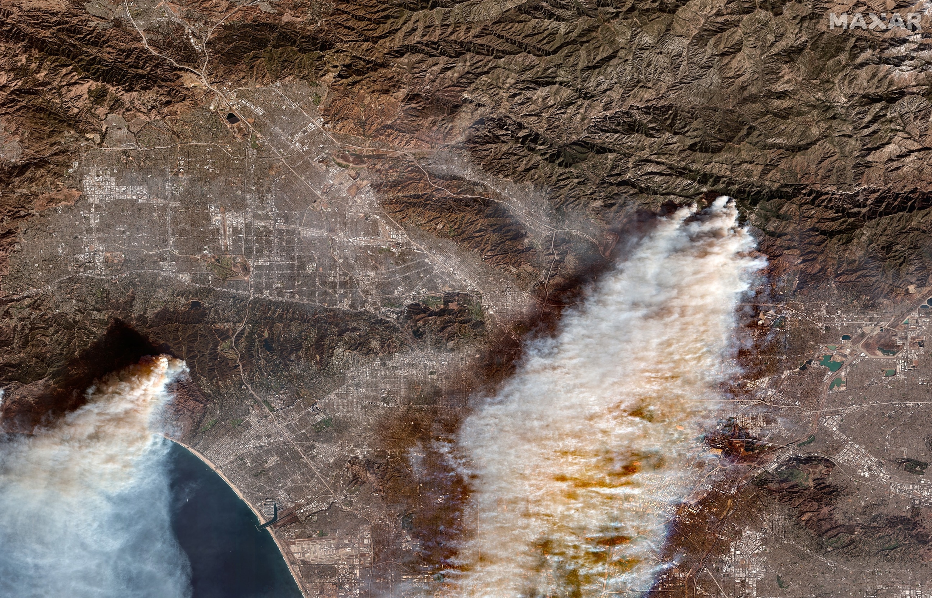
Overview of Palisades and Eaton Wildfires in a satellite image provided by MaxarTechnologies.
@MaxarTechnologies
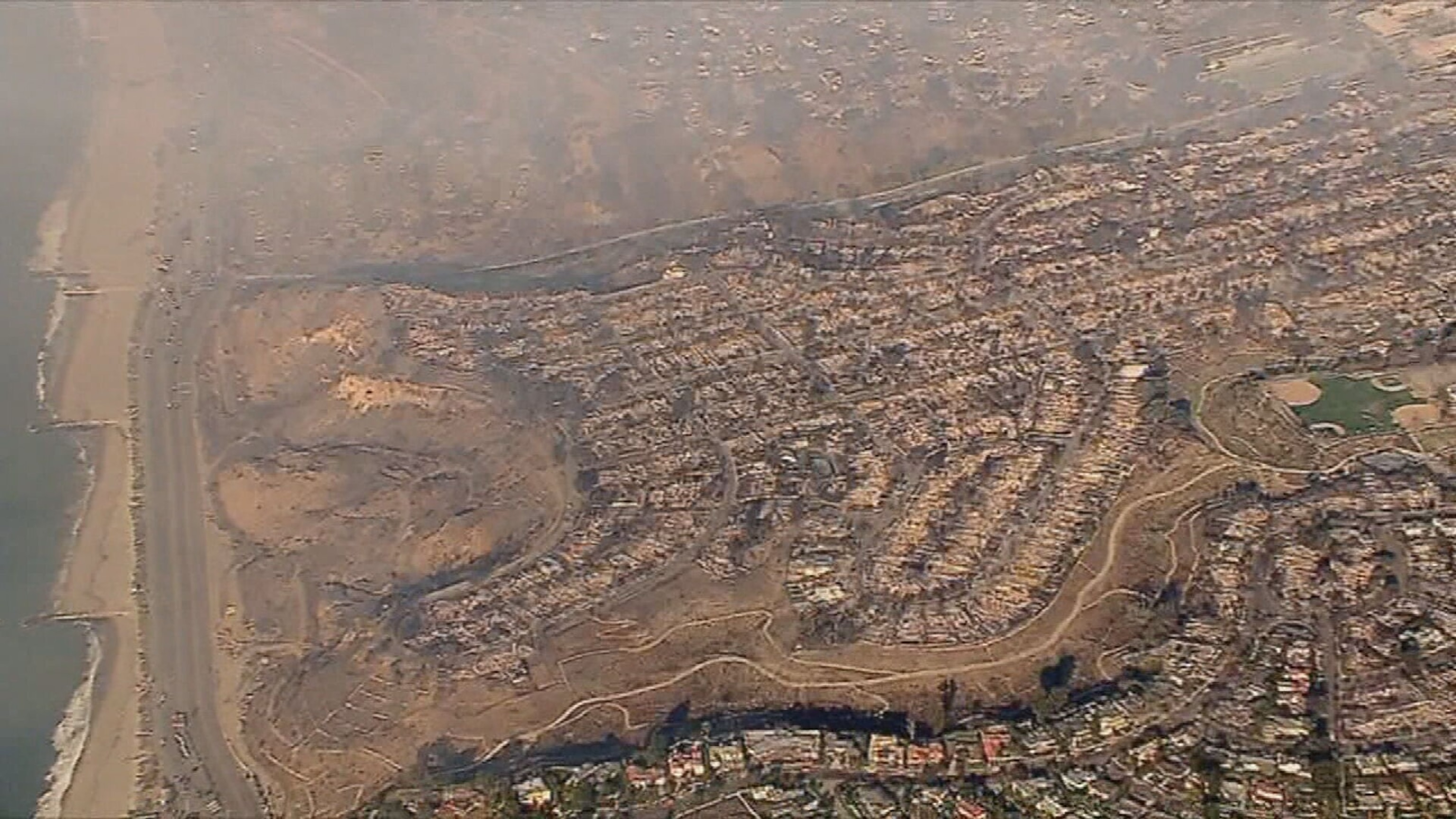
Aerial view of the Pacific Palisades neighborhood on Jan. 9, 2025.
KABC
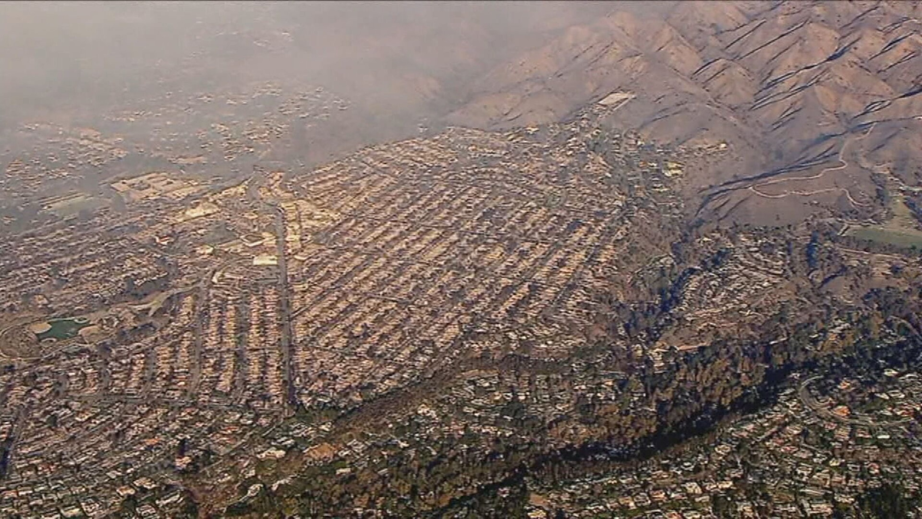
Aerial view of the Pacific Palisades neighborhood on Jan. 9, 2025.
KABC
Birdseye view of a neighborhood in Altadena, CaliforniaA market in Altadena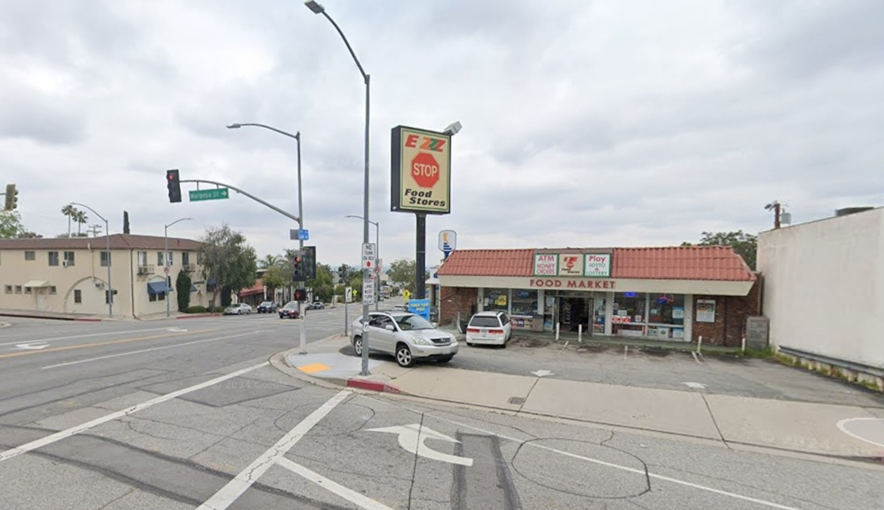
The Ezzz Stop Food Store is shown in Altadena, Calif.
Google Maps Street View
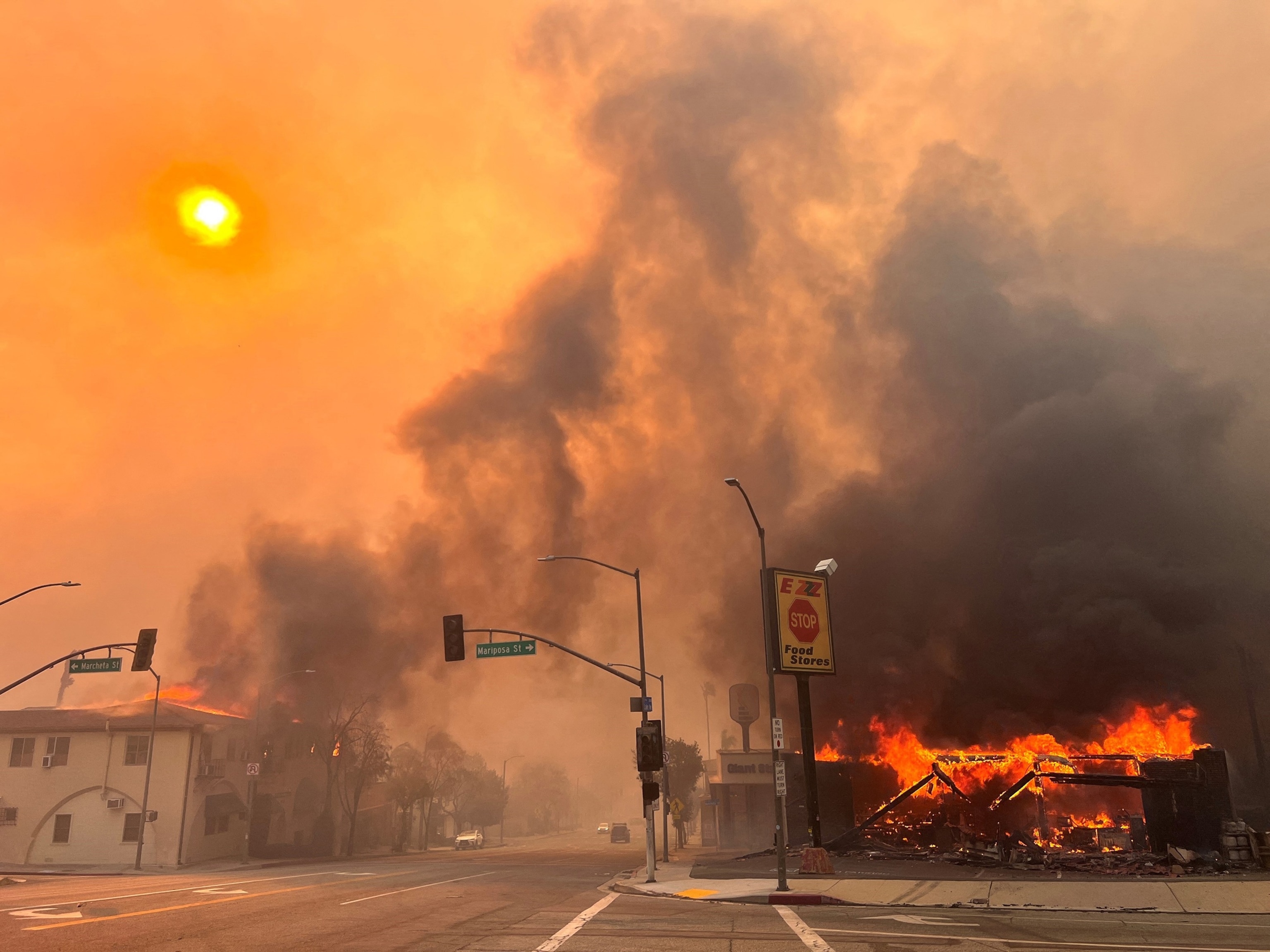
Flames from the wind-driven Eaton Fire engulf a structure in Altadena, California, Jan. 8, 2025.
Robyn Beck/AFP via Getty Images
Pacific Coast HighwaySunset Boulevard in Los Angeles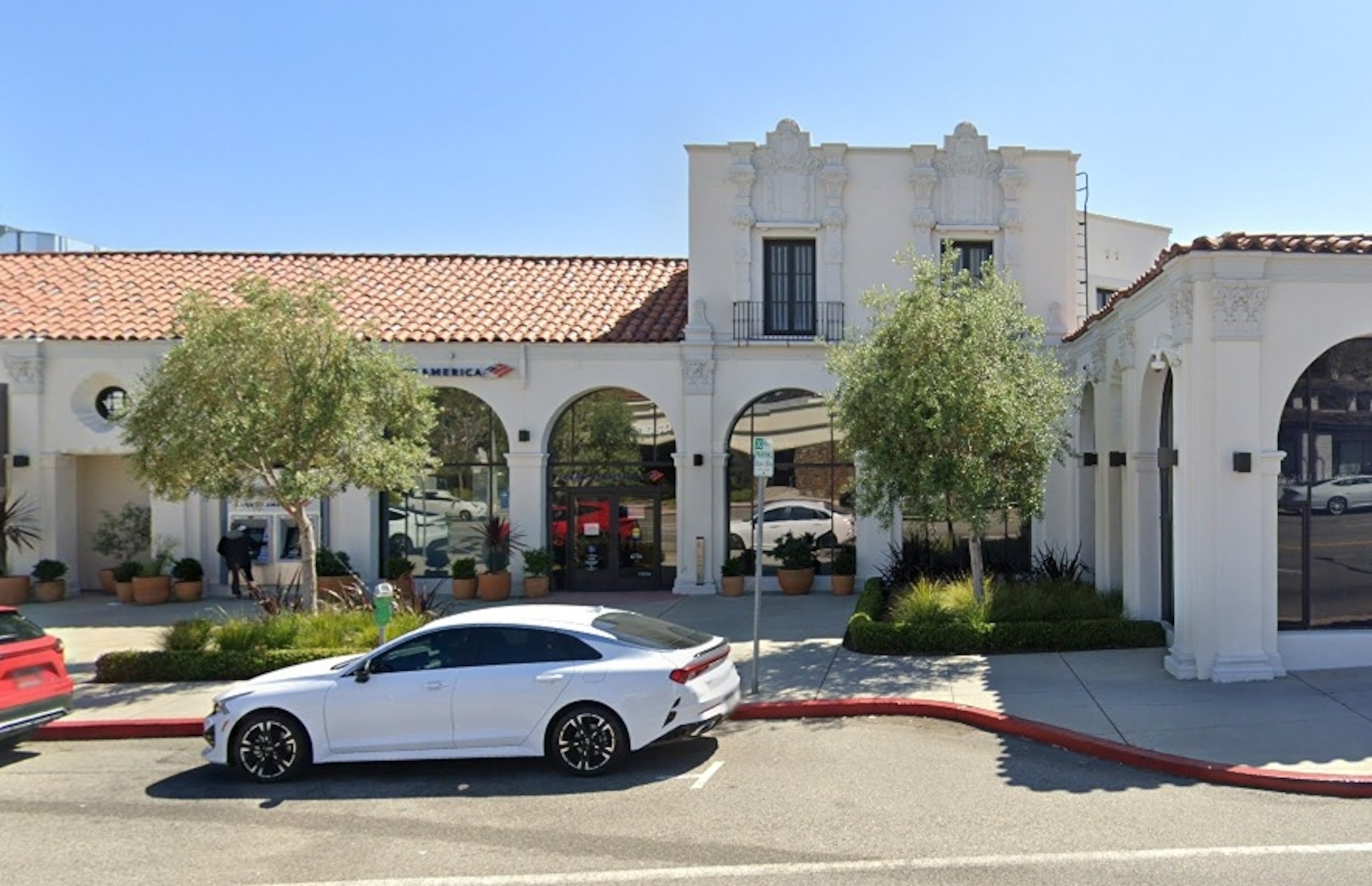
A Bank of America location is shown on Sunset Boulevard in Los Angeles.
Google Maps Street View
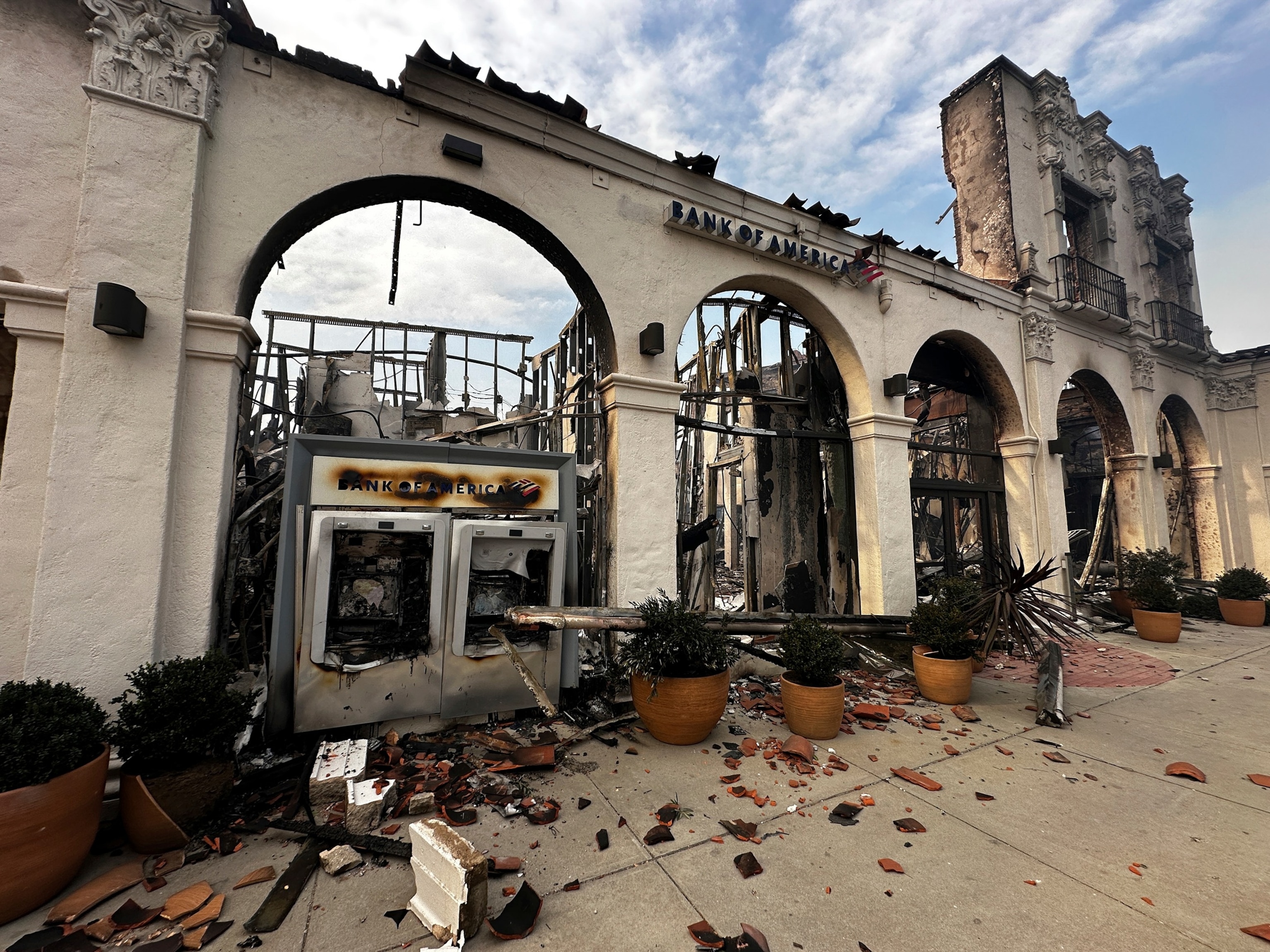
A fire-damaged Bank of America branch is seen after the Palisades Fire swept though in the Pacific Palisades neighborhood of Los Angeles, Jan. 8, 2025.
Eugene Garcia/AP
Altadena Senior Center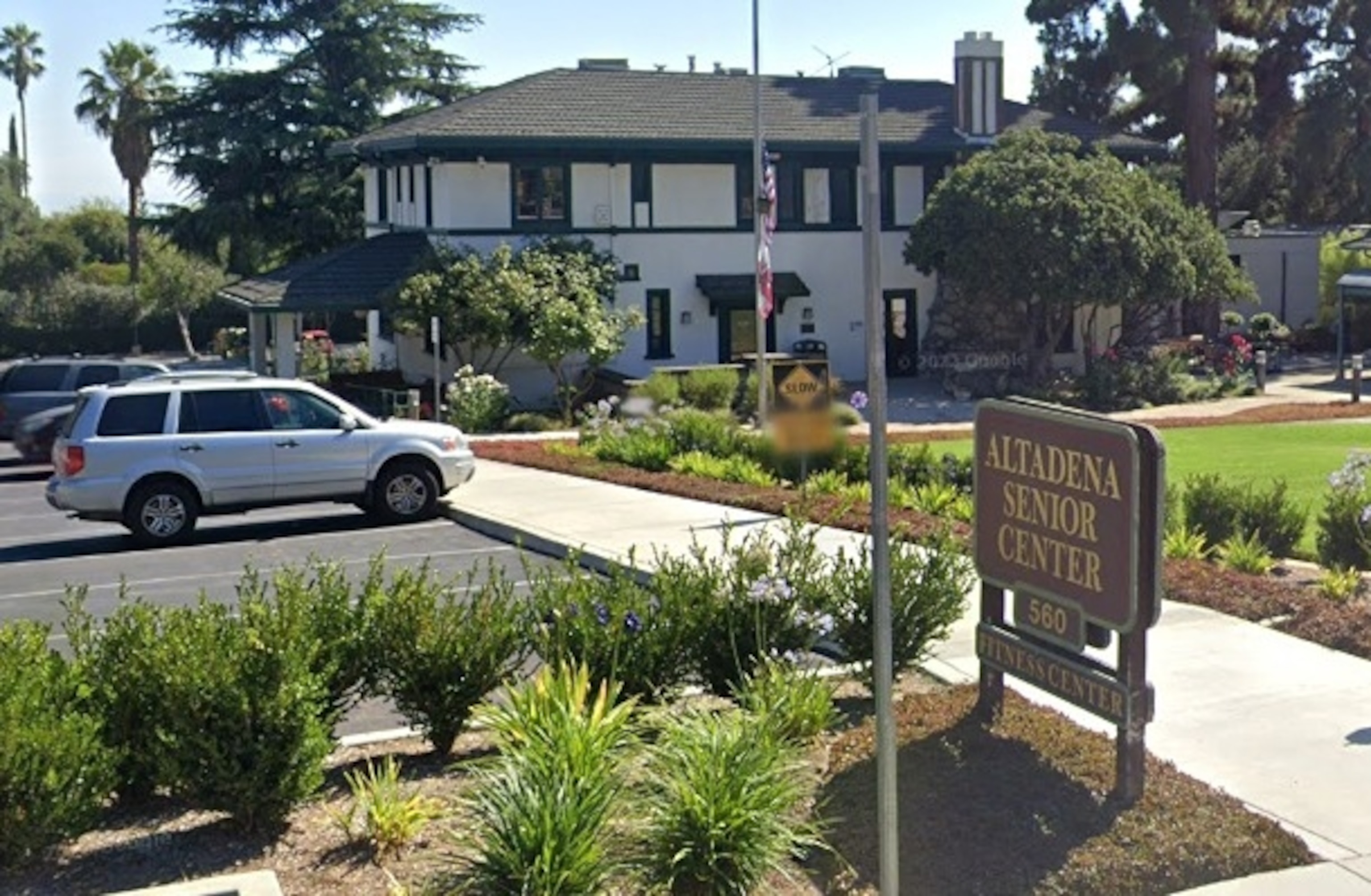
The Altadena Senior Center is shown in Antadena, Calif.
Google Maps Street View
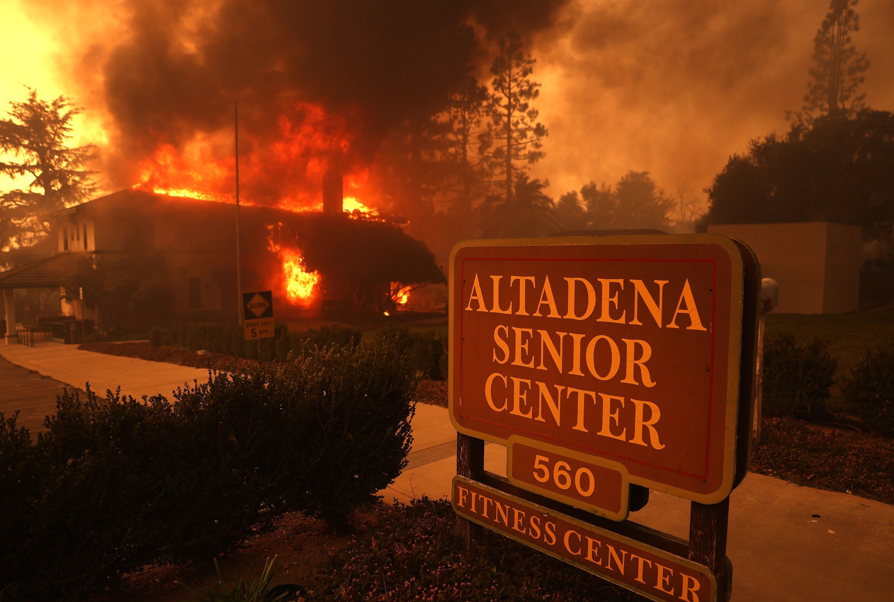
The Altadena Senior Center burns as the Eaton Fire moves through the area on Jan. 8, 2025, in Altadena, Calif.
Justin Sullivan/Getty Images
Altadena Auto Center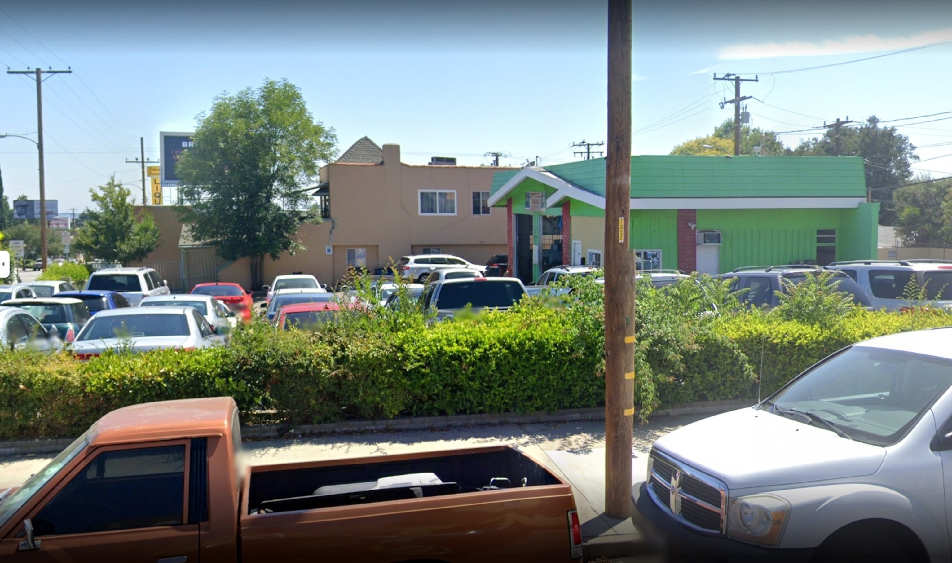
The Altadena Auto Center is shown in Altadena, Calif.
Google Maps Street View
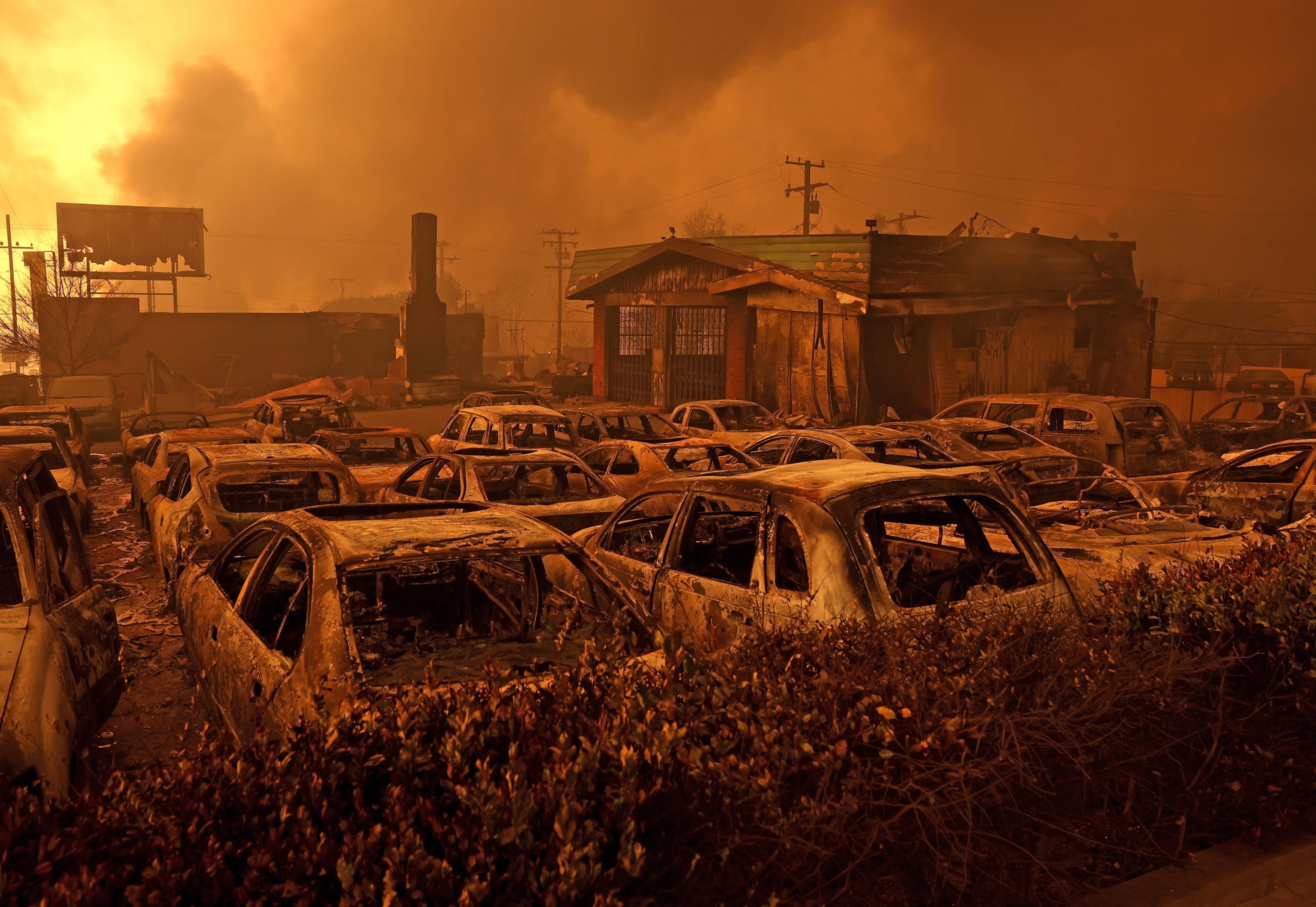
Cars destroyed by the Eaton Fire sit in the parking area of a burned auto shop on Jan. 8, 2025, in Altadena, Calif.
Justin Sullivan/Getty Images
A private residence in Altadena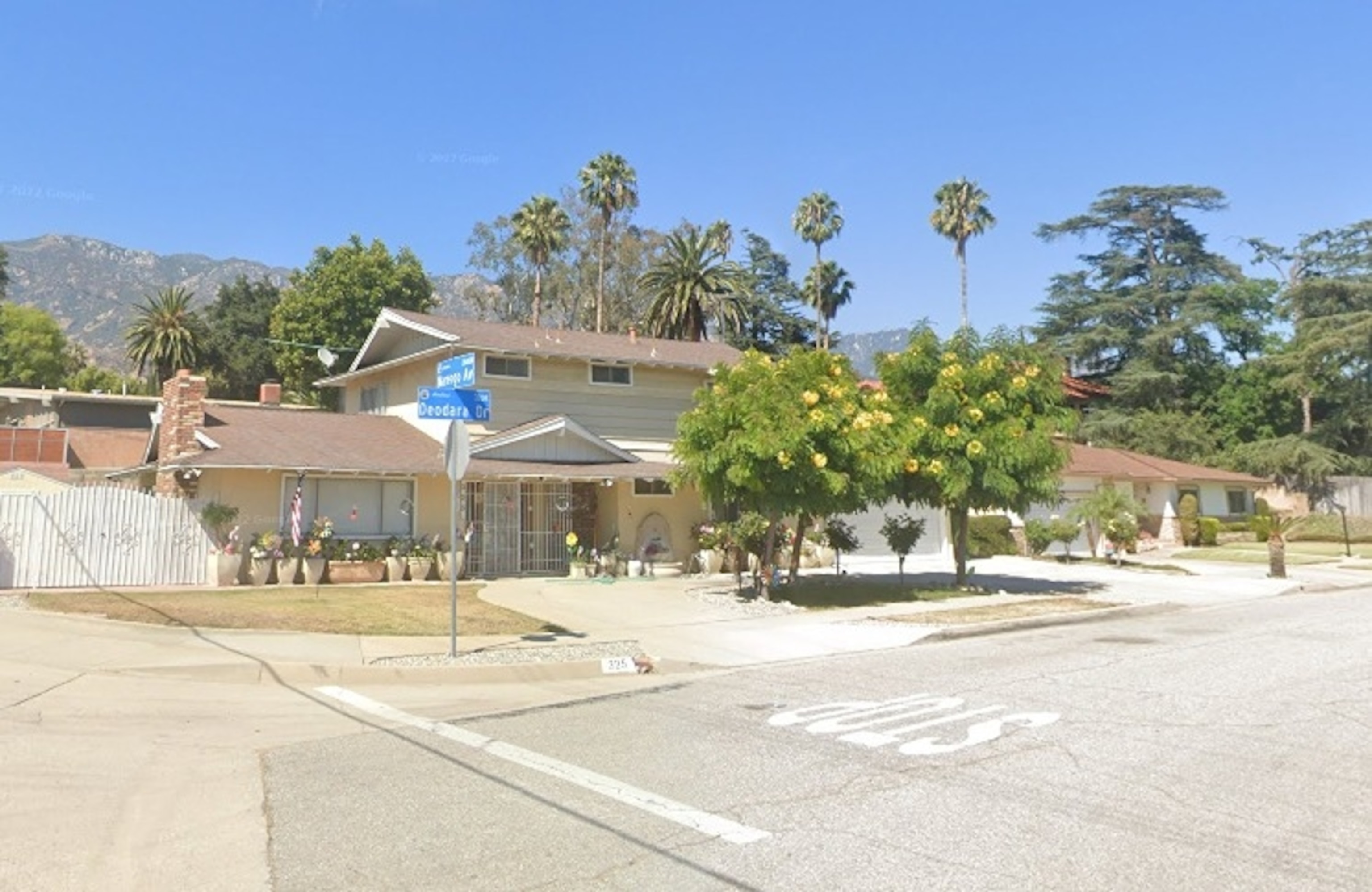
A house on Deodara Drive is shown in Altadena, Calif.
Google Maps Street View
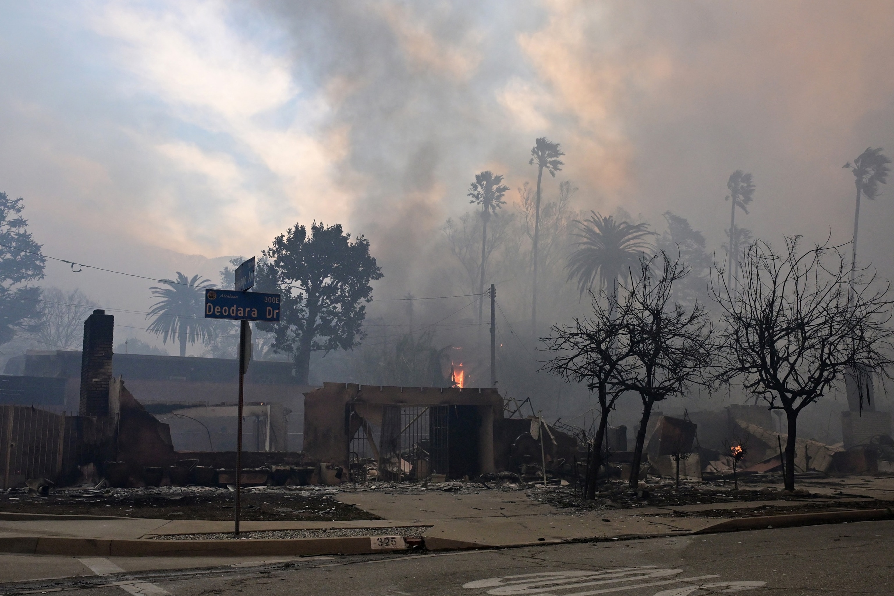
Structures burned by the Eaton fire are seen in Altadena, Calif., on Jan. 8, 2025.
Robyn Beck/AFP via Getty Images
Temescal Canyon Park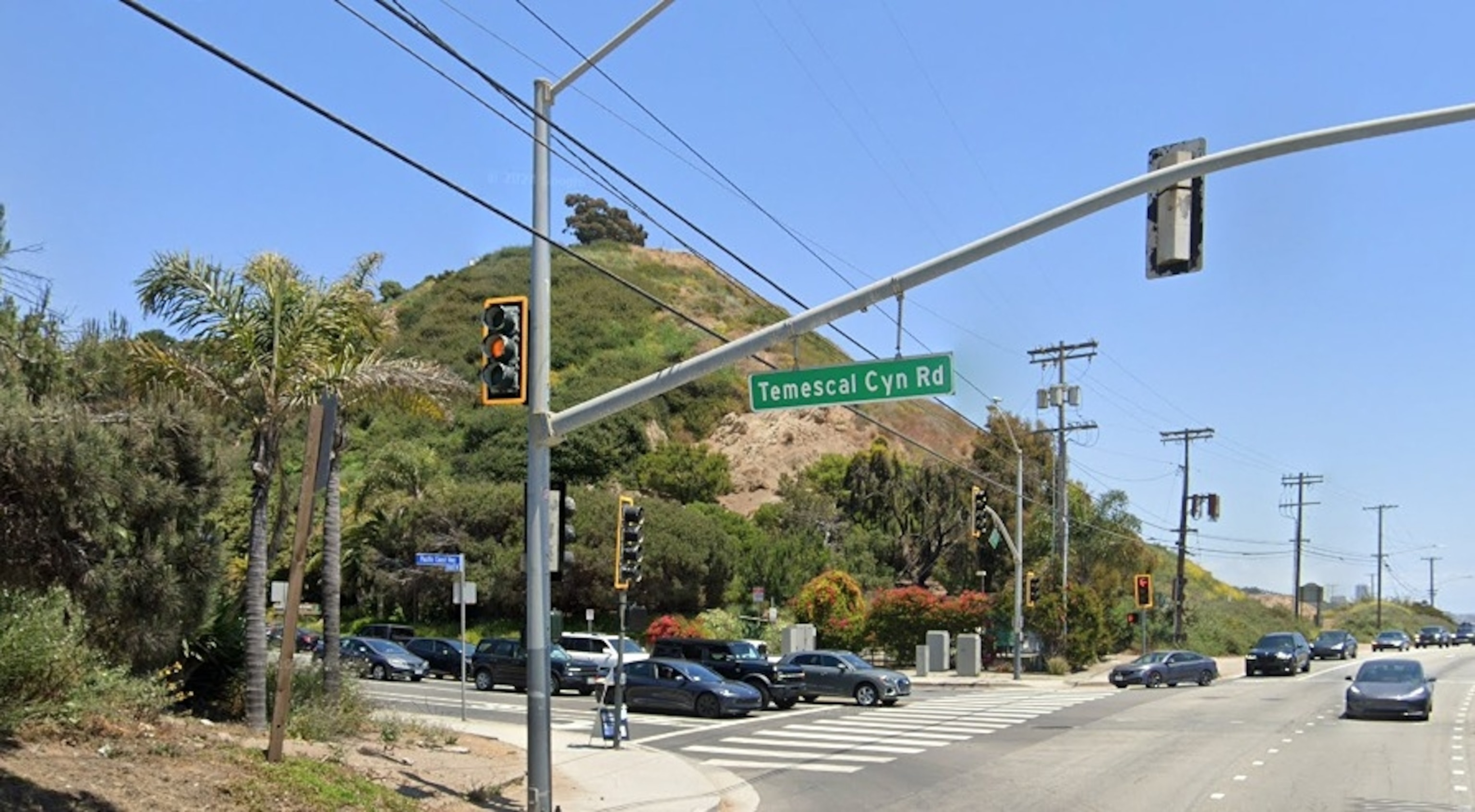
Temescal Canyon Road is shown in Los Angeles.
Google Maps Street View
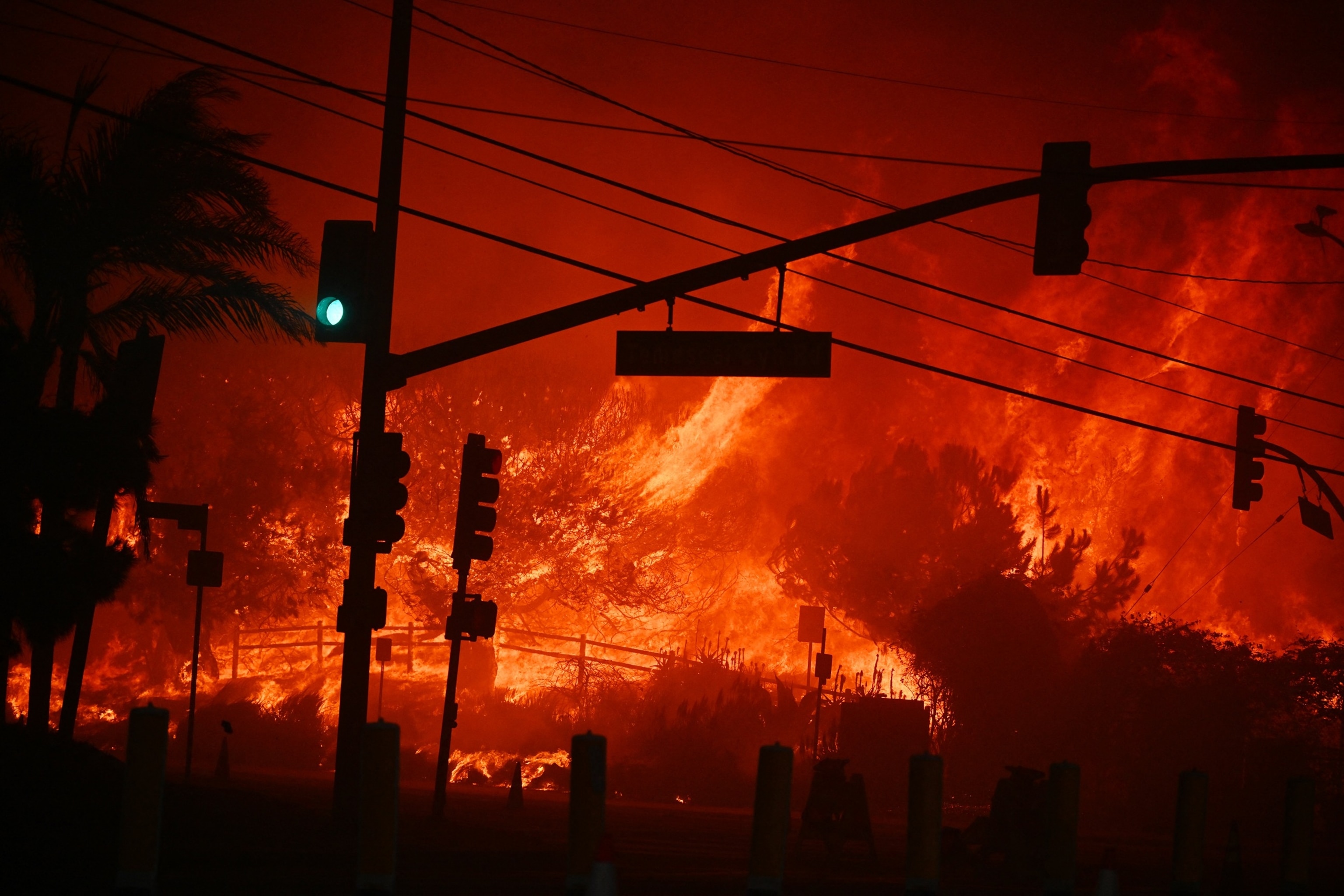
Flames overtake the intersection of Temescal Canyon and Pacific Coast Highway Fire at the Palisades Fire in Pacific Palisades California on Jan. 7, 2025.
Robyn Beck/AFP via Getty Images
Homes near Fair Oaks Avenue in Altadena
Source link : http://www.bing.com/news/apiclick.aspx?ref=FexRss&aid=&tid=67808d65c53c42f780f75cfd014a66ae&url=https%3A%2F%2Fabcnews.go.com%2FUS%2Fafter-wildfires-devastation-california%2Fstory%3Fid%3D117499669&c=8263218738429413390&mkt=en-us
Author :
Publish date : 2025-01-09 13:36:00
Copyright for syndicated content belongs to the linked Source.

