For the latest information on storm activity in the Cayman Islands, as well as information on how to prepare for hurricane season, visit Storm Centre.
Local forecasters are advising the community to expect possible flooding in low-lying areas as an increase in rainfall coupled with higher than normal high tides impact the islands over the coming days.
The National Weather Service, in its Thursday morning forecast, says that a tropical wave over the Cayman area and a broad area of low pressure over the southwest Caribbean will interact over the next 24 hours, bringing cloudy to overcast skies with periods of rain and heavier showers.
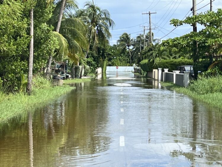
Heavy showers like this one can be expected Thursday into Friday, the National Weather Service has said. – Photo: Reshma Ragoonath
“Some of these showers … along with higher-than-normal tide levels, may lead to flooding in low-lying areas. Radar images show scattered showers in and around the Cayman area drifting towards the northwest,” the forecast stated.
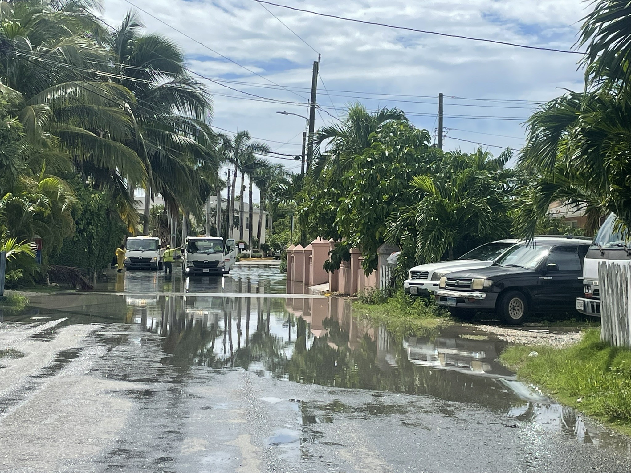
Already high tides had caused flooding on some streets in North Sound Estates on Thursday morning.
Rainfall had also caused some street flooding in George Town.
A small craft advisory will take effect from Thursday night through at least the afternoon of Monday.
The National Hurricane Center in Miami, the forecast added, has marked an area south of Cayman with a 20 percent chance of development over the next 7 days.
The NHC, in a Thursday morning advisory, said some gradual development of this system is possible over the next couple of days before it moves inland over Central America.
The National Weather Service says it will continue to monitor this area for any development.
A second system, identified as AL94 and located east of the Leeward Islands, is also being monitored at this time.
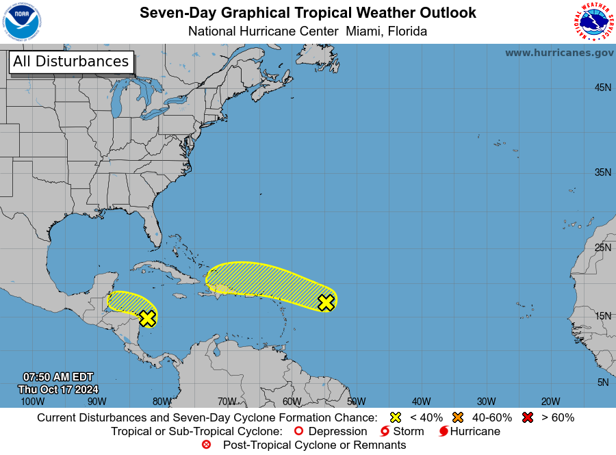 This National Hurricane Center graphic shows the systems currently being monitored for development. – Photo: US National Hurricane Center
This system is producing showers and thunderstorms associated with a trough of low pressure and remains disorganised.
“Some slow development is possible during the next few days as the disturbance moves quickly westward to west-northwestward around 20 mph, passing near the Virgin Islands and Puerto Rico on Friday, then near Hispaniola and the southeastern Bahamas on
Saturday. Strong upper-level winds should end the chances of development by late in the weekend,” the US National Hurricane Center stated Thursday morning.
It has a 30% formation chance through the next seven days.
Showers expected
The National Weather Service has said that through Thursday cloudy to overcast skies with periods of rain and heavier showers with some thunder can be expected.
 A car drives through floodwater on Paxton Road off Smith Road, George Town on Thursday morning. – Photo: Sarah Bridge
“Showers may become locally heavy at times leading to possible flooding of low-lying areas. Temperatures will rise to the mid to upper 80s °F,” it said.
Winds will be east to southeast at 10 to 15 knots with higher gusts and heavy showers.
Seas, it said, will be moderate with wave heights of 3 to 5 feet and will be choppy to rough with heavy showers.
Overnight, the forecast said, overcast skies with periods of rain and heavier showers with some thunder can be expected.
Showers may become locally heavy at times, also leading to possible flooding of low-lying areas.
Winds will be east to southeast at 15 to 20 knots with higher gusts and heavy showers. Seas will be moderate to rough with wave heights of 5 to 7 feet.
Small craft should exercise caution over the open seas.
On Friday, the forecast calls for overcast skies with periods of rain and heavier showers with some thunder.
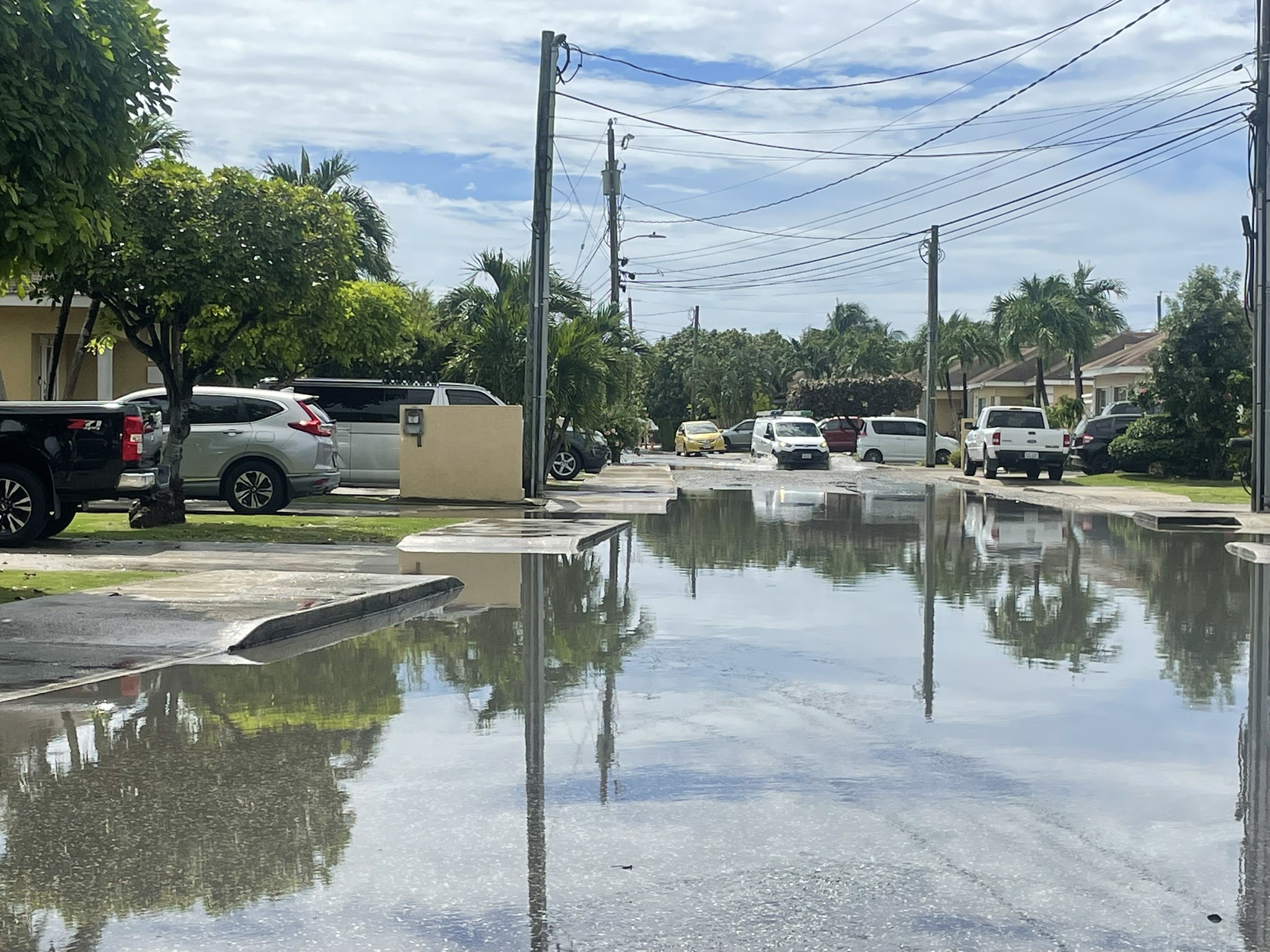
 A van goes through floodwaters on Hope Drive, George Town on Thursday. – Photo: Sarah Bridge
Similar to the previous projections, the forecast says showers may become locally heavy at times leading to possible flooding of low-lying areas.
Winds will be east to northeast at 15 to 20 knots with higher gusts and heavy showers.
Moderate to rough seas can be expected with wave heights of 5 to 7 feet. Seas will be choppy to rough with heavy showers.
A decrease in cloudiness and showers can be expected from Friday evening “as the tropical wave moves over the Western Caribbean and low-pressure system is expected to move over the northern coast of Honduras,” the forecast stated.
Source link : http://www.bing.com/news/apiclick.aspx?ref=FexRss&aid=&tid=67116e7a7f69433bb45ded8c901020f6&url=https%3A%2F%2Fwww.caymancompass.com%2F2024%2F10%2F17%2Fweather-service-says-more-rainfall-possible-flooding-ahead%2F&c=2732958842295621726&mkt=en-us
Author :
Publish date : 2024-10-17 07:32:00
Copyright for syndicated content belongs to the linked Source.


