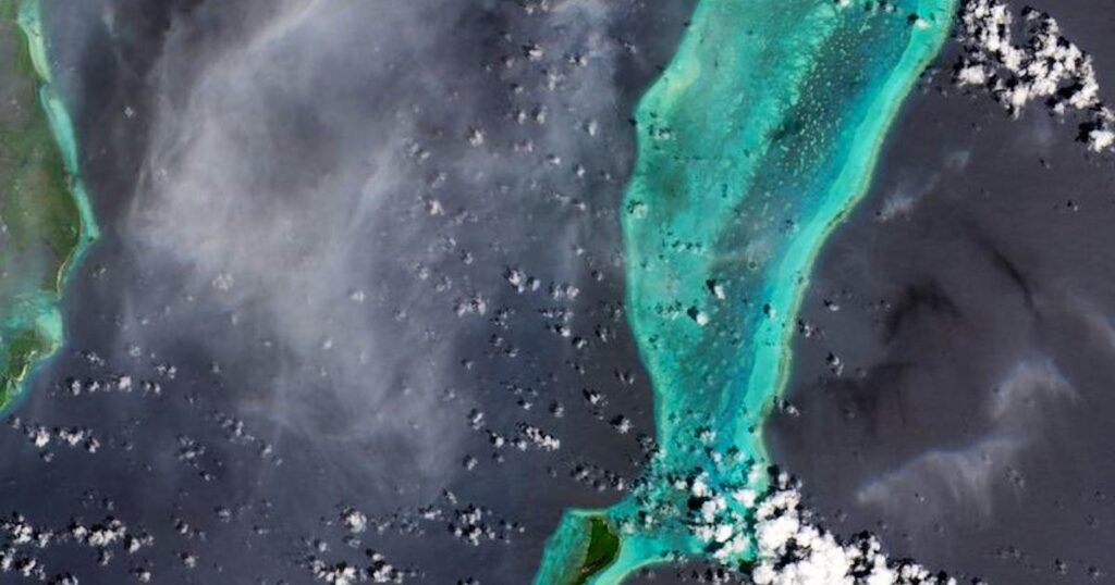
The satellite image from Sentinel-2C shows Lighthouse Reef, part of the large coral reef system off the coast of Belize in Central America. Here you can see the famous Great Blue Hole – a huge marine sinkhole.
Here, Sentinel-2C has observed a forest fire in an area south of Los Angeles in California.
One of the satellite’s images offers a clear view of Seville and the surrounding area in southern Spain. Seville, the capital of Andalusia, is located on the Guadalquivir River, one of the longest rivers in Spain
The new Sentinel-2 mission combines high-resolution and novel multispectral capabilities, a swath width of 290 km and frequent repeat imaging to provide views of the Earth’s changing landscapes in unprecedented detail.
The Sentinel-2 satellite was launched at the beginning of September and is now delivering its first images. The satellite is intended to provide data on agriculture, water quality and natural disasters.
No time? blue News summarizes for you
The Sentinel-2 satellite, which was launched around two weeks ago, has delivered its first images.”We are thrilled that Copernicus “Sentinel-2C” is already capturing such breathtaking images of the Earth so soon after its launch,” said Constantin Mavrocordatos, Sentinel-2 project manager at Esa.The satellite of the European earth observation program Copernicus is to provide data for agriculture, for monitoring water quality and for managing natural disasters such as forest fires, volcanic eruptions and floods.
A Sentinel-2 satellite launched at the beginning of September has delivered its first images from an altitude of 786 kilometers – including some of a forest fire in California. The satellite of the European Earth observation program Copernicus is intended to provide data for agriculture, water quality monitoring and the management of natural disasters such as forest fires, volcanic eruptions and floods, according to the European Space Agency Esa.
“We are thrilled that Copernicus “Sentinel-2C” is already capturing such breathtaking images of Earth so soon after its launch,” said Constantin Mavrocordatos, Sentinel-2 project manager at Esa. “This is just the beginning of the incredible insights and detailed data it will provide, which will help us to better understand our planet.”
“Sentinel-2C” was launched on September 5 on board a rocket from the European spaceport in French Guiana on the northeast coast of South America. Two other Sentinel-2 satellites are already on their way, collecting data as part of Europe’s Copernicus earth observation program.
dpa
Source link : http://www.bing.com/news/apiclick.aspx?ref=FexRss&aid=&tid=66eb59fcd3e44f87ab52433ddb12e418&url=https%3A%2F%2Fwww.bluewin.ch%2Fen%2Fnews%2Fcopernicus-satellite-delivers-spectacular-photos-for-the-first-time-2372019.html&c=12212898086699435365&mkt=en-us
Author :
Publish date : 2024-09-18 11:04:00
Copyright for syndicated content belongs to the linked Source.
