An iceberg floats in Disko Bay, off the coast of Greenland.
Sean Gallup / Getty Images
As the ice that covers Greenland melts, land freed from its weight gradually rises in a process known by scientists as isostatic rebound. The pressure that once compressed the Earth’s crust eases, and Greenland and its collection of coastal islands rises by millimeters each year.
In addition to this upward movement, the melting ice affects the surrounding ocean. Ice sheets exert a gravitational pull on nearby water, drawing the sea toward the ice mass. As the ice melts, this pull weakens, and the water redistributes around the globe. This redistribution can cause local sea levels near Greenland to drop slightly, while raising sea levels in more distant regions.
“The net effect of ice sheet melt is going to be a shallowing of the sea level rather than the sea-level rise that you get in the rest of the world,” says Tinto, “and that was where we had different questions coming in and touching each other.”
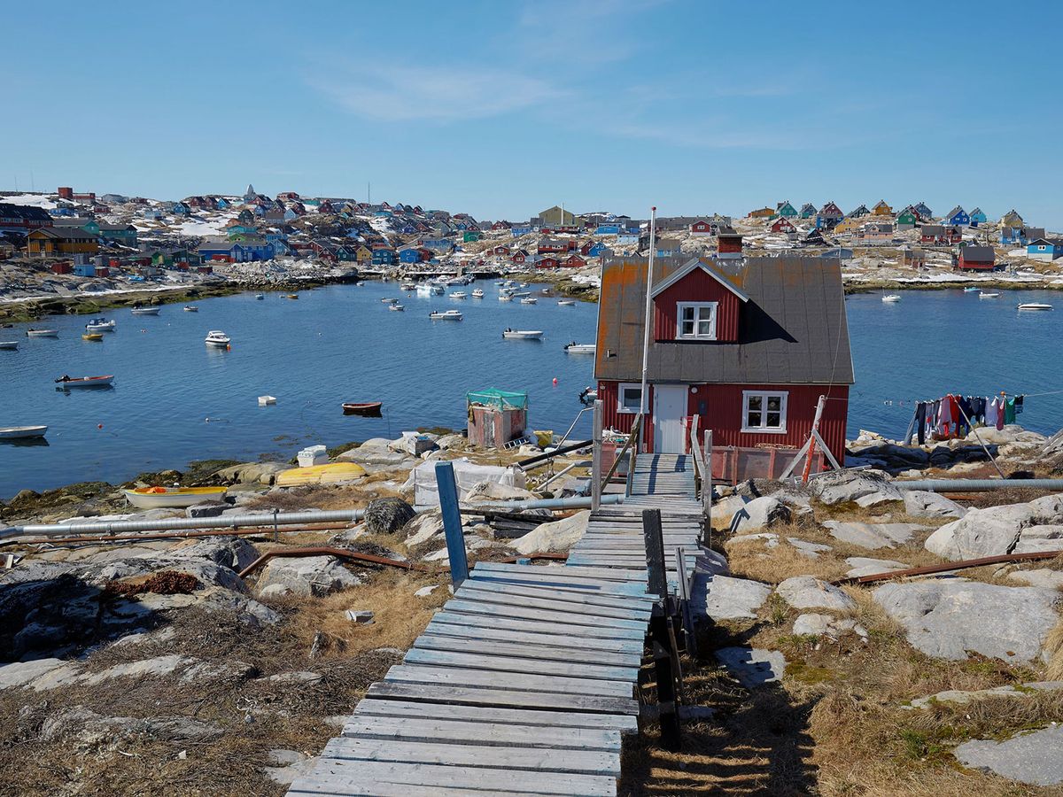
Tinto and her team set out to determine how the coastline of Greenland would change as the sea level goes down. The National Science Foundation-funded project looks at four Greenlandic shallow-water communities—Kullorsuaq, Nuuk, Tasiilaq and Aasiaat. Over the ensuing years, the researchers aim to study the bathymetry—or ocean floor—of the surrounding waters. They want to provide the local community with a clearer picture of the emerging seascape and how it will impact their lives.
“We can say the sea level is going to drop between one and three meters in Greenland by the year 2100, but what does that mean for a person who lives on the coast if you don’t have the bathymetry mapped to accuracy?” says Tinto. “What difference does it really make?”
As the land changes and coastal channels become shallower, it could have a big impact on marine life. Some areas of water might become cut off from each other, isolating entire regions and blocking the flow of nutrients that keep ecosystems healthy. This shift could be especially harmful for young fish that rely on coastal habitats to grow and develop, making it harder for them to survive. For humans, navigation channels will become shallower and increasingly treacherous, and ultimately safe passage may be rendered impossible. Access to the water will grow more challenging as new obstacles emerge in the harbor.
“There aren’t roads between the towns. If you want to go between towns you’re going by boat,” says Tinto. “So the depth of the harbor changing is fundamentally as important as roads going underwater elsewhere.”
In addition to their bathymetry work, the researchers are collaborating with the local community. They are putting bathymetry data into an app used for navigating, printing maps and holding digital story maps in three languages—Greenlandic, Danish and English. The app will ensure that the science behind future projections is accessible to the community.
For decades, island residents have observed firsthand the gradual changes in their environment. “Locals have noticed that the rocks are becoming more and more exposed,” says Tinto. “The human time scale can remember back a generation or two, which is longer than our instrumental period in this area.”
Aqqaluk Sørensen, a Nuuk local and geophysicist for the Greenland Institute of Natural Resources, shared that older hunter-fishermen in the community have noticed a big change. Small patches of land that were underwater 70 years ago are now above the waterline—and can even be used to cut up their catches of fish.
“The local people are really interested in the data we’re collecting, particularly the bathymetry mapping and videos of the seafloor,” says Sørensen, who collaborated on the project. “In many places, like Kullorsuaq, they don’t even have charts to see how deep the surrounding seas are, so this was the first time some of them saw what their own seafloor looked like. As scientists, that’s something we take for granted.”
Sørensen says that the grade-school books used in the area all predict a rise in sea levels. The information from the researchers has spurred the local community to re-evaluate their expectations.
Lamont-Doherty geophysicist Robin E. Bell, another researcher on the project, says the study of bathymetry became a bridge between scientists and the local community. The parties have meaningful conversations about the changes they’re observing and how to prepare for the future.
“Like any change, knowing about it will allow the community to adapt as the land rises,” says Bell, who highlights scientists’ efforts to make the information accessible in local schools and research institutions. “Fostering the growth of Greenlandic scientific expertise will ensure the rising land and falling sea levels are considered in future planning for posts, docks and other infrastructure.”
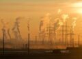
Already, the Greenland ice sheet is losing ice at an accelerating rate. It is one of the largest sources for current sea-level rise, and its melting has serious implications for coastal communities worldwide. However, how fast and how much of the ice sheet will melt depends on future emissions, other climate actions and natural variability within the ice sheet.
Yet the task of making these projections meaningful to local communities is equally critical. As climate models improve, the focus shifts to communicating actionable insights to regions that will experience sea-level rise differently.
“What I find most interesting about this project is they’ve really interwoven the science with the needs of local communities,” says Fiamma Straneo, an oceanographer and planetary scientist at Harvard University. “Western-world scientists don’t know on our own what most fits a community’s needs.”
And Greenland is not alone in experiencing a different sea-level rise compared to much of the world. In western Antarctica, for example, land is also rising as the ice melts. The increasing release of freshwater contributes to a global sea-level rise, just as the melting does in Greenland.
“What happens in this ice sheet and how it contributes to the ocean does affect absolutely everyone on Earth,” says Tinto, “but figuring out how to make these projections relevant to an individual community is really important as well.”
Get the latest Science stories in your inbox.
Filed Under:
Arctic,
Arctic Ocean,
Atlantic Ocean,
Climate Change,
Coast,
Glaciers,
Greenland,
Oceans,
Water
Source link : http://www.bing.com/news/apiclick.aspx?ref=FexRss&aid=&tid=6750d77aef9945b88ab531bd48cfab11&url=https%3A%2F%2Fwww.smithsonianmag.com%2Fscience-nature%2Fas-greenlands-ice-sheet-melts-an-island-town-rises-180985514%2F&c=1965114788740031058&mkt=en-us
Author :
Publish date : 2024-12-03 00:01:00
Copyright for syndicated content belongs to the linked Source.


