
Guyana (Officially, the Co-operative Republic of Guyana) is divided into 10 administrative regions: Barima-Waini, Cuyuni-Mazaruni, Demerara-Mahaica, East Berbice-Corentyne, Essequibo Islands-West Demerara, Mahaica-Berbice, Pomeroon-Supenaam, Potaro-Siparuni, Upper Demerara-Berbice, and Upper Takutu-Upper Essequibo. These regions are further subdivided into a total of 27 neighborhood councils.
Covering an area of 215,000 sq. km, Guyana is South America’s 3rd smallest nation. Located in the Demerara-Mahaica region, at the mouth of the Demerara River on the Atlantic coast is Georgetown – the capital and largest city of Guyana. It is the principal administrative center and also serves as the chief seaport and the main commercial and manufacturing centers of Guyana.
Where is Guyana?

Guyana is a country located on the northern edge of South America. It is geographically positioned both in the Northern and Western hemispheres of the Earth. Guyana is bordered by Suriname to the east; by Venezuela to the west; by Brazil to the south and southwest; and by the Atlantic Ocean to the north. Guyana shares its maritime borders with Barbados and Trinidad and Tobago.
Guyana Bordering Countries:
Brazil, Suriname, Venezuela.
Regional Maps: Map of South America
Outline Map of Guyana
Key Facts
Legal Name
Cooperative Republic of Guyana
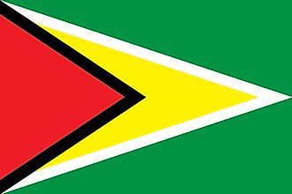
Flag
Capital City
Georgetown
6 48 N, 58 09 W
Total Area
214,969.00 km2
Land Area
196,849.00 km2
Water Area
18,120.00 km2
Population
782,766
Currency
Guyanese dollars (GYD)
GDP
$4.28 Billion
GDP Per Capita
$5,468.36
This page was last updated on December 13, 2023
Source link : https://www.worldatlas.com/maps/guyana
Author :
Publish date : 2023-12-13 03:00:00
Copyright for syndicated content belongs to the linked Source.


