Tropical Storm Sara has made landfall in Honduras and is lashing Central America with ‘life-threatening’ torrential rains.
Sara hit land late Thursday about 105 miles northwest of the Cabo Gracias a Dios, a cape located near the Honduras-Nicaragua border.
As of early Friday morning, Sara has maximum sustained winds of 45mph, though forecasters warn it could strengthen if the storm center stays offshore.
The National Hurricane Center (NHC) expects Sara to provoke ‘life-threatening and potentially catastrophic flash flooding and mudslides’ and heavy rain up to 30inches across Honduras before moving on to Belize on Sunday.Â
The storm could bring double-digit rainfall to other parts of Central America and southern Mexico, which forecasters say could mean ‘widespread areas of life-threatening and potentially catastrophic flash flooding and mudslides.’
Through early next week, Sara is expected to hit El Salvador, eastern Guatemala, western Nicaragua, and the southern Mexican state of Quintana Roo.Â
The system could evolve into a hurricane, reaching a Category 3 status, and hit Florida by Wednesday next week, AccuWeather meteorologists predicted.
Forecasters warned that Hurricane Sara would unleash significant downpours, leading to flash flooding, strong wind gusts that may also pose a significant risk to lives and property.
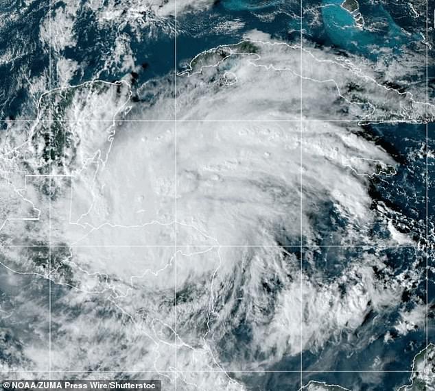
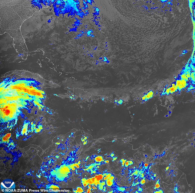
Tropical Storm Sara, pictured in a satellite image, has made landfall in Honduras and is lashing Central America with ‘life-threatening’ torrential rains. Sara hit land late Thursday about 105 miles northwest of the Cabo Gracias a Dios, a cape near the Honduras-Nicaragua border
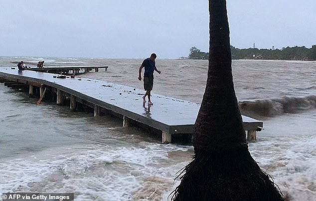
A man walks on a wharf ahead of the arrival of tropical storm Sara in West Bay, Roatan, Honduras on November 14, 2024
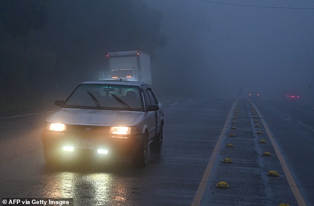
A car drives through heavy fog ahead of the arrival of tropical storm Sara in Siguatepeque, Honduras on November 14, 2024
Sara made landfall in Honduras near Brus Laguna, a village of about 13,000 inhabitants. There are few other population centers nearby.
At 3am local time the NHC said the storm was located about 65miles east-southeast of Belize City in Honduras and moving west at 9mph with maximum sustained winds of 45mph.
The storm was expected to remain roughly on that path before heading out to sea again and threatening the coast of Belize.
Sara was forecast to pass over or very near the tourist destination of Roatan off Honduras’ coast on Sunday. The storm was then expected to turn northwesterly toward Belize and the Yucatan Peninsula.
Mexican authorities warned it could cause ‘intense rains’ over the resort-studded Yucatan Peninsula.
Sara is forecast to drop 10 to 20inches of rain, with up to 30inches in isolated areas. The heavy rain could lead to life-threatening flooding and landslides, the center said.
Multiple scenarios for what could happen to Sara after its interaction with Honduras and the Yucatán Peninsula are possible in the coming days.
All eyes on are Florida after new hurricane models showed that the tropical rainstorm is likely to batter the state next week.Â
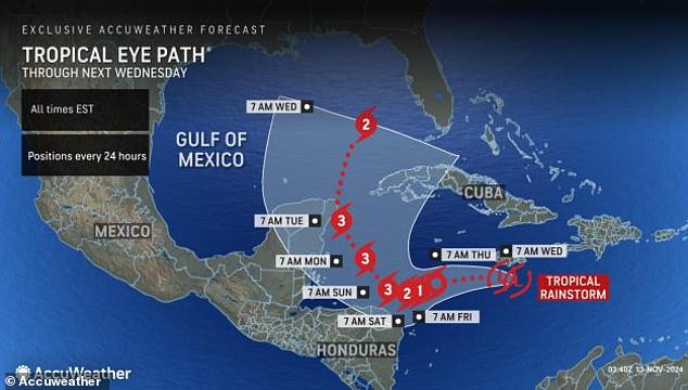
AccueWeather revealed Sara could reach Florida by next Wednesday
Multiple scenarios for what could happen to Sara after its interaction with Honduras and the Yucatán Peninsula are possible in the coming days

Reporters arrive at Francisco Morazan stadium for a Honduras national team training session ahead of a CONCACAF Nations League quarterfinals first leg soccer match against Mexico, in San Pedro Sula, Honduras, Thursday, November 14, 2024
Sara is gaining strength as it moves closer to the Gulf of Mexico, where it will travel between Cuba and Mexico on Monday before turning sharply north the following day.
AccuWeather predicted that the track of the storm would provide it fuel to become a potentially significant hurricane,’ impacting the Florida Keys and the southern part of the Florida Peninsula.’
The NHC also reported Wednesday that there is a 90 percent chance of it becoming a low-pressure system with winds up to 39 miles per hour within the next 48 hours.
‘An Air Force Hurricane Hunter aircraft is scheduled to investigate this system later today,’ the agency said.
Meteorologists warn all residents in the central and eastern Gulf coast to closely monitor the storm’s progression, noting that it’s still too early to determine where the storm will end up.
AccuWeather meteorologist Alex DaSilva said: ‘There are multiple scenarios with the feature in the Caribbean that are tied to the speed of development and track early on that could affect land areas with landfall and direct impacts later on.Â
‘Not only does this have a high chance of becoming a hurricane by the end of this week, but it may become a major hurricane very quickly – this weekend.’Â
The NHC reported that Sara will steadily intensify as it ‘continues to produce a large area of showers and thunderstorms’ in the Caribbean Sea.Â
Experts say areas of south Florida will likely see several inches of rain which could cause localized flooding next week.
The Caribbean Sea has been a hotspot for tropical storm and hurricane development this season due to its warmer-than-average temperatures that extends 300 to 400 feet below the ocean’s surface.
‘This can act like rocket fuel for developing tropical storms or hurricanes,’ said DaSilva.Â
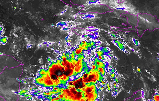
Sara is currently a tropical rainstorm in the Caribbean, but experts say it could develop into a Category 3 hurricane next week
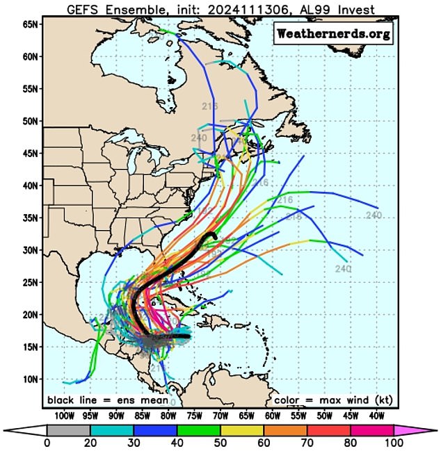
Meteorologists are monitoring several scenarios of the storm’s path, but AccuWeather noted one for sure shows Sara hitting Florida ‘significant impacts next week’
A combination of warm waters and low wind sheer over the Gulf of Mexico creates the perfect storm for a rapidly developing weather event.
And on top of those facts, Sara is likely to take the same path as Hurricane Rafael, collecting the remnants as fuel.Â
The storm could take advantage of ‘some unusually conducive late-season conditions’ to strengthen into the early part of next week,’ wrote Michael Lowry, a hurricane specialist and storm surge expert with WPLG-TV, on his blog.
Meteorologists are monitoring several scenarios of the storm’s path, but AccuWeather noted one for sure shows Sara hitting Florida ‘significant impacts next week.’
That means the Sunshine State will see a fourth hurricane in the 2024 season.Â
‘Should the feature become a hurricane, it would be the 12th of the season, which is a testament to the supercharged nature of the season, where the historical average is seven hurricanes,’ DaSilva said.Â
However, other predictions show a path into Central America or southeastern Mexico later this week into next week.
This potential route shows Sarah diminishing over the region or possibly begin a turn toward the Gulf of Mexico and losing wind intensity, meaning it ‘may not have time to regain hurricane strength before any approach the Florida Peninsula.’
Source link : http://www.bing.com/news/apiclick.aspx?ref=FexRss&aid=&tid=673f09e278a541f29b1661852b99303a&url=https%3A%2F%2Fwww.dailymail.co.uk%2Fnews%2Farticle-14086593%2FTropical-Storm-Sara-landfall-Honduras-lashes-life-threatening-rain.html&c=9764217699507122650&mkt=en-us
Author :
Publish date : 2024-11-14 21:50:00
Copyright for syndicated content belongs to the linked Source.


