
[En español]
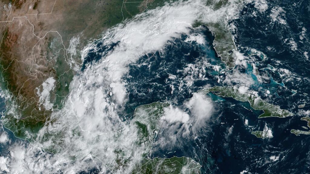
A broad area of low pressure over Central America, southern Mexico, and the surrounding waters is expected to interact with a stalled front and the remains of Tropical Depression 11-E from the Eastern Pacific to create a tropical disturbance capable of developing into a tropical or subtropical storm in the Gulf of Mexico next week. If such a storm did develop, the odds are low that it would become a damaging landfalling hurricane like Helene; it is far more likely that the storm would be a large, disorganized heavy rainmaker for Florida.
Figure 1. Track forecasts out to eight days for the Gulf of Mexico from the 6Z Friday, October 4, run of the GFS ensemble model. Individual forecasts of the 31 ensemble members are the lines color-coded by the wind speed in knots they predict; red colors correspond to a Category 1 hurricane. Four members predicted a strong tropical storm or Cat 1 hurricane threat for Florida. (Image credit: weathernerds.org)
Lukewarm model support for development
Fortunately, upper-level winds over the Gulf of Mexico in the coming week are not conducive for a powerful hurricane to form, and there will be plenty of dry air to interfere with development. The Friday morning runs of the GFS and European model ensembles had little support for a hurricane developing in the Gulf and instead favored a loosely organized heavy rainmaker that would form in the western Gulf and then move east, bringing heavy rains of three to seven inches (76-152 mm) to much of Florida (Fig. 2). Regardless of whether a named storm forms in the Gulf, Florida can anticipate a five-day period of heavy rains beginning on Sunday.

In its 8 a.m. EDT Friday Tropical Weather Outlook, the National Hurricane Center gave two-day and seven-day odds of development of a tropical or subtropical cyclone in the Gulf of Mexico of 0% and 40%, respectively.
Kirk peaks as a Cat 4 in the open Atlantic
After peaking as a Category 4 storm with 145 mph (235 km/h) winds and a central pressure of 934 mb at 5 a.m. EDT Friday, Hurricane Kirk has begun a slow weakening trend. At 11 a.m. EDT Friday, Kirk was safely located in the central tropical Atlantic, about 975 miles (1,570 km) east-northeast of the northern Leeward Islands. Top sustained winds were 140 mph (220 km/h), and satellite imagery suggested that Kirk was undergoing an eyewall replacement cycle, causing some weakening.
#Kirk is now a Category 4 #hurricane with max winds of 130 mph while at ~47°W. This shatters the record for farthest east an Atlantic Category 4-5 hurricane has occurred in October-November. Old record was Hurricane Sam in 2021 on 2 October at ~60°W. pic.twitter.com/HBPloZicu2
— Philip Klotzbach (@philklotzbach) October 3, 2024
Models are in strong agreement that Kirk will continue to weaken over the next few days as it rounds the west side of a strong subtropical ridge of high pressure and then angles northward and northeastward on a classic recurvature track, staying far from land until after it becomes a post-tropical cyclone embedded in the mid-latitude jet stream. Post-tropical Kirk is expected to bring strong winds of 50-60 mph (80-95 km/h) and heavy rain to Western Europe on Wednesday.
Large swells from Kirk reached the Leeward Islands on Friday, will affect Bermuda and the Greater Antilles on Saturday, and then the East Coast of the United States and the Bahamas on Sunday, making for potential rip currents and dangerous beach conditions.


Tropical Storm Leslie
Tropical storm Leslie, located at 11 a.m. EDT Friday in the remote tropical Atlantic about 670 miles (1,075 km) west-southwest of the Cabo Verde Islands, was an intensifying tropical storm with top sustained winds of 65 mph (100 km/h) and a central pressure of 996 mb. Leslie is expected to peak as a Category 2 hurricane with 105 mph (170 km/h) winds on Monday as it heads northwest into the central Atlantic. Leslie is not a threat to any land areas.
Hurricane Helene Fatality Total: 223+
{285+ Remain Missing}
➼110+ in North Carolina [200+ Remain Missing]
•72+ in Buncombe County
•9 in Yancey County
•6 in Henderson County
•5 in Avery County
•4 in Haywood County
•2 in Cleveland County
•2 in Watauga County
•1 in Catawba…
— Weather Fatalities (@WXFatalities) October 4, 2024
Hurricane Helene aftermath
There are many worthy charities helping out in the aftermath of the devastation wrought by Hurricane Helene, and I encourage everyone to consider a donation. The one I am supporting is the Partnership for Inclusive Disaster Strategies (formerly Portlight.org), founded by members of the Weather Underground community. Their focus is on the needs of people with disabilities.
Disabled impacted by #Helene, need help? Discapacitade impactade por Helene y necesita ayuda?
Call/text (llame) Disability & Disaster Hotline 800-626-4959 or hotline@disasterstrategies.org
in NC oxygen/oxigeno try/trata the county EM https://t.co/ajA0hKjKiD
or let us know pic.twitter.com/QrTxd3oyA5
— The Partnership for Inclusive Disaster Strategies (@disasterstrat) October 3, 2024
Bob Henson contributed to this post.
We help millions of people understand climate change and what to do about it. Help us reach even more people like you.
Source link : http://www.bing.com/news/apiclick.aspx?ref=FexRss&aid=&tid=670049fdf4f346cfaae6d879a3f98504&url=https%3A%2F%2Fyaleclimateconnections.org%2F2024%2F10%2Fwatching-the-gulf-of-mexico-for-tropical-storm-formation%2F&c=3317655720383552104&mkt=en-us
Author :
Publish date : 2024-10-04 05:43:00
Copyright for syndicated content belongs to the linked Source.