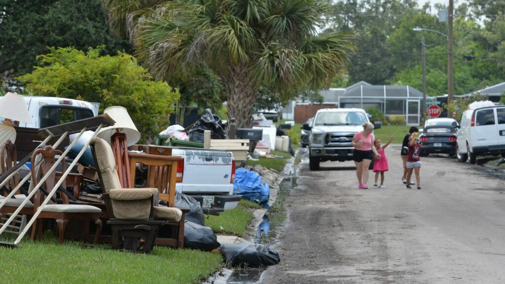
Hurricane Debby buffeted and soaked our fellow Floridians in the west and north this past week with Category 1 winds and prodigious rainfall. Lake City recorded 20 inches of rain, Sarasota nearly 18 inches, and then Debby continued to drench Georgia and the Carolinas with double-digit precipitation as it slogged northeast.
Back in late June and early July, Hurricane Beryl became the earliest-forming Category 5 storm on record, devastating several islands in Grenada, as well as St. Vincent and the Grenadines, before moving on to landfalls in Mexico and the Texas Gulf Coast as a weaker storm.
Amid all this, it was just a little bit heartening last week to learn that the storm predictions from two hurricane forecasters was slightly better than the initial outlook.
On Tuesday, the team at Colorado State University, which had predicted 25 named storms at the beginning of the season, reduced that to 23. And Thursday, the National Oceanic and Atmospheric Administration trimmed its expectation of 17 to 25 storms to 24 at the upper end.
CSU still expects 12 hurricanes, six of them Category 3 or higher. And NOAA predicts 8 to 13 hurricanes, four to seven of those being major.
But there was a caveat Thursday from NOAA’s Climate Prediction Center, which said the La Niña effect, which encourages storms, is expected to develop in September, which could lengthen the hurricane season into November or December.
All of which reminds us that the overall outlook remains daunting — a new storm was brewing in the Atlantic as of Friday — as federal weather officials made certain to point out.
“Atmospheric and oceanic conditions have set the stage for an extremely active hurricane season that could rank among the busiest on record,” NOAA said in its updated hurricane forecast message Thursday. “With the peak of hurricane season quickly approaching, NOAA’s National Weather Service urges everyone to know their risk; prepare for threats like damaging winds, storm surge and inland flooding from heavy rainfall; and to have a plan if asked to evacuate.”
Wise words, those. We all know how this goes: Storm’s paths and intensities are still hard to predict with pinpoint accuracy, and we all ride the panic-don’t panic rollercoaster with each official update as cyclones brew over the blistering seas and consider a stopover in South Florida.
So while we can’t take too much comfort from this smallest of moves in a positive forecast direction, we can do what we know we need to do, and that’s be ready. Be prepared to evacuate. Have supplies on hand for the hardships that will come with property damage and power failures. Make sure your house is as protected as it can be when it looks like it will be taking it on the chin from a powerful hurricane.
At some point, perhaps the nations of the world will come up with a way to mitigate the warming of the planet, which is contributing to hyperactive storm seasons and the extreme floods that accompany them. Until then, forewarned is forearmed, whether it’s five or 25 storms.
Source link : http://www.bing.com/news/apiclick.aspx?ref=FexRss&aid=&tid=66ba12160d63439dbbc99550b13ff9c0&url=https%3A%2F%2Fwww.palmbeachdailynews.com%2Fstory%2Fopinion%2Feditorials%2F2024%2F08%2F12%2Fhurricane-news-a-reminder-that-we-need-to-be-prepared%2F74735350007%2F&c=16522621782749313546&mkt=en-us
Author :
Publish date : 2024-08-12 02:02:00
Copyright for syndicated content belongs to the linked Source.
